
IREC PROJECT PORTFOLIO

Signature Projects

Engineering, geospatial intelligence and environmental insight behind technically demanding infrastructure across India.

Railways & transportEngineering & GISEnvironment
INFRASTRUCTURE THAT CONNECTS PEOPLE, PLACES & SYSTEMSIREC · INDIA
SELECTED EXPERIENCE

Key Assignments, Real Impact.

Explore selected projects and the specialist work delivered by IREC.

View by sector:
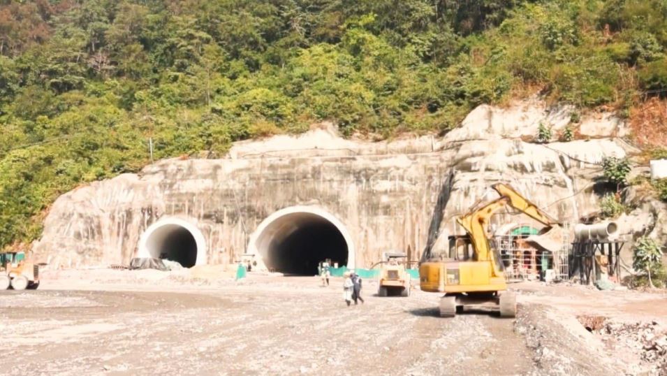
Rishikesh–Karnprayag railway project; replace with approved project photography if neededRAILWAYS · UTTARAKHAND
FLAGSHIP PROJECT EXPERIENCE

Rishikesh–Karnprayag New BG Rail Project

Forest Diversion, Environmental Planning & Geospatial Support

IREC’s experience includes forest and environmental consultancy assignments associated with the Rishikesh–Karnprayag rail project, supported by forest proposal preparation, drone surveys, digital mapping and environmental management planning.
Uttarakhand, India RVNL association since 2017*
▤
20+Forest proposals prepared and pursued*
⌖
40+ haCumulative forest area covered*
◇
190+ haCumulative drone survey coverage*
◷
2017–Present*Association period, subject to records
❧Forest diversion proposals
⌖Drone surveys & mapping
▧Environmental planning
♧Wildlife management plans
⌁Soil & moisture conservation
View Project Details →Related Projects
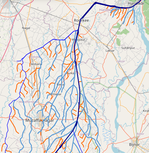
cGanga canal network GIS map
GIS DATABASE · WATER RESOURCES

Digital Database of 25,000 km Canal Network & Drainage Systems

DGPS Survey, Chadar Map Scanning & GIS Digitization

Development of a digital canal-network and drainage database for cGanga, associated in IREC’s brochure with a consortium of seven IITs and the National Institute of Hydrology (NIH), Roorkee. IREC’s work included DGPS surveys of canal networks, scanning chadar maps containing canal L-sections, and digitization of the canal network for 10 divisions.

Ganga Basin, India cGanga · Consortium of 7 IITs · NIH Roorkee
⌁
25,000 kmNetwork and drainage system scale cited in brochure
▦
10Divisions covered by canal digitization
⌖
DGPSField survey of canal networks
▤
7 IITs + NIHAssociated consortium context
⌖DGPS canal surveys
▤Chadar map scanning
⌁L-section map records
▧Canal network digitization
Project Overview →Related Projects
PROJECT SCOPE

From field-surveyed control to a structured canal GIS database

The stated workflow combined DGPS field surveys, scanning of departmental chadar maps containing canal L-sections, and GIS digitization of canal networks across 10 divisions. The IREC brochure identifies the assignment as a digital database development project for cGanga, in association with a consortium of seven IITs and NIH Roorkee.
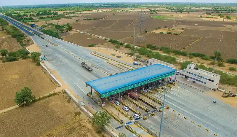
NH-2 highway widening projectHIGHWAYS · UTTAR PRADESH
HIGHWAYS & EXPRESSWAYS

NH-2 Widening to Six Lanes

Highway Design & Infrastructure Engineering

IREC undertook the design for widening the 192 km NH-2 Varanasi–Aurangabad corridor in Uttar Pradesh from four lanes to six lanes for SOMA Roadis.
Varanasi–Aurangabad, Uttar Pradesh Client: SOMA Roadis
↔
192 kmProject corridor
⇄
4 → 6 lanesWidening scope
⌖
Uttar PradeshProject location
▤
SOMA RoadisClient
↔Six-lane widening
⌖Highway corridor
▤Highway design
Project Overview →Related Projects
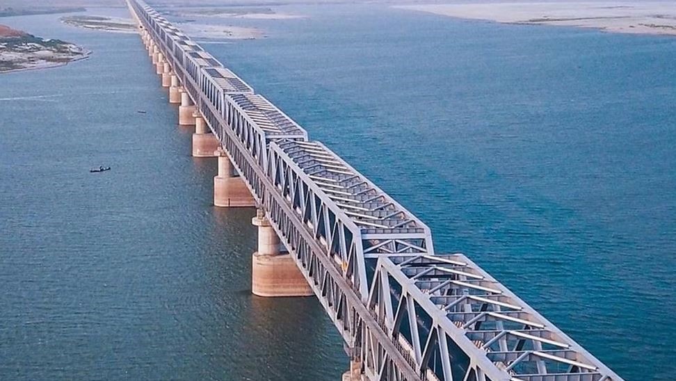
Ganga Railway Bridge project at PatnaBRIDGES · BIHAR
RAILWAY BRIDGE INFRASTRUCTURE

Ganga Railway Bridge, Patna

Railway Infrastructure & Tender Documentation

IREC’s project experience includes tender-document preparation for a proposed railway bridge over the River Ganga at Patna, described in project records as a 6 km PPP-based assignment.
Patna, Bihar IRCON / IDeC association*
↔
6 km*Bridge length as stated in project records
▤
TenderDocument preparation
◇
PPP*Project model as stated in records
⌖
PatnaBihar, India
▤Tender documentation
↔Railway bridge infrastructure
◇PPP project documentation*
Project Overview →Related Projects
Almora urban tunnel projectTUNNELS · UTTARAKHAND
URBAN TUNNEL INFRASTRUCTURE

Almora Urban Tunnel Project

Urban Connectivity & Tunnel Planning

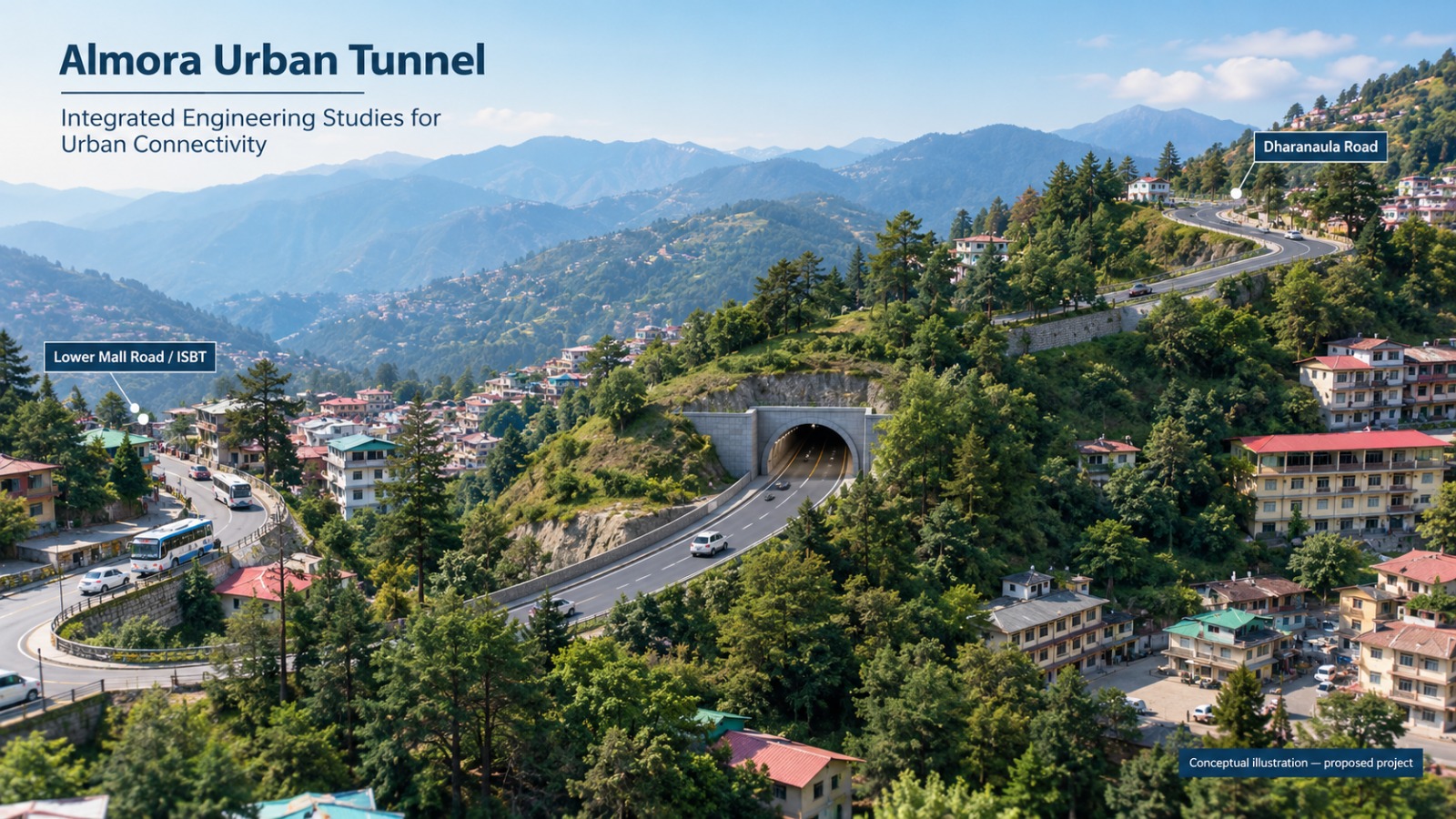
Urban tunnel connection between Dharanaula Road and Lower Mall Road in Almora, Uttarakhand. The stated elevation is approximately 1,685 m above mean sea level.
Almora, Uttarakhand Urban connectivity
⌖
AlmoraUttarakhand
↔
Urban tunnelConnectivity concept
⌁
1,685 m*Approx. elevation stated
▤
PlanningScope to confirm
↔Urban tunnel connectivity
⌖Terrain and location context
▤Tunnel planning*
Project Overview →Related Projects
Lanka–Silchar broad-gauge railway line projectRAILWAYS · ASSAM
RAIL ALIGNMENT & GEOSPATIAL SUPPORT

Lanka–Silchar BG Rail Line Project

Railway Alignment Assessment & GIS Analysis

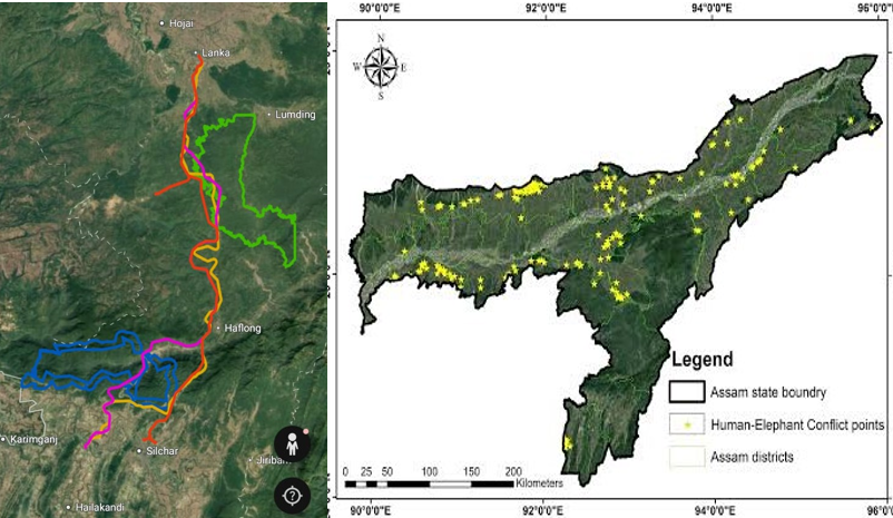
IREC’s project experience includes geospatial assessment supporting railway alignment planning for the Lanka–Silchar broad-gauge rail corridor in Assam. This summary is intentionally limited to the alignment and GIS context; confirm the specific deliverables, client and project status before publication.
Lanka–Silchar corridor, Assam Railway planning
⌖
AssamProject region
↔
BG railBroad-gauge corridor
⌁
GISSpatial assessment
▤
AlignmentRailway planning
⌁GIS and spatial analysis
↔Railway alignment assessment
⌖Corridor planning support
Project Overview →Related Projects
Airport study for Minicoy and Agatti in LakshadweepAVIATION · LAKSHADWEEP
AIRPORT PLANNING & ENVIRONMENT

Minicoy & Agatti Airport Study

Traffic Assessment, EIA & Coral Study

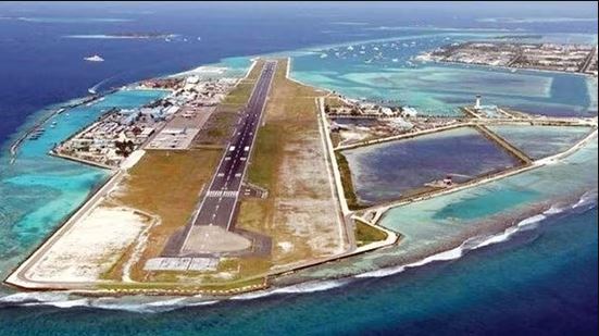
IREC’s project experience includes study work for the proposed airport developments at Minicoy and Agatti in Lakshadweep, covering traffic assessment, Environmental Impact Assessment (EIA), and coral study.

Lakshadweep, India Airport planning & environmental studies
↗
TrafficTraffic assessment
▤
EIAEnvironmental impact assessment
♧
CoralCoral study
⌖
2 islandsMinicoy & Agatti
↗Airport traffic assessment
▤Environmental Impact Assessment
♧Coral study
⌖Island airport study
Project Overview →Related Projects
Explore All Projects →